-
GENERAL OUTLOOK ABOUT HUMANITARIAN DEMINING OPERATIONS
This is box titleThe humanitarian demining purpose is the complete removal of mines and dangerous materials of the terrain and the restoring to the economical and social circuit of this one acording with UN standarts ( 99,6 % at a depth of 200 mm). Humanitarian demining is not time limited. -
GENERAL OUTLOOK ABOUT HUMANITARIAN DEMINING OPERATIONS
This is box titleHumanitarian demining procedures are nonconventional and one applied acording with terrain particularities and type of mines. Humanitarian demining consists: – land survey supporte; – survey; – clearance; – cleared terrain verification. -
GENERAL OUTLOOK ABOUT HUMANITARIAN DEMINING OPERATIONS
This is box titleLand survey supporte consists in : providing products and topografic information updated and accurate; terrain analysis; providing topogeodezic tools; Precise survey on topographic maps/plans of mined and demined areas in order to provide accurate records for deminers, local authorities and armed forces -
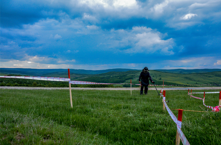
GENERAL OUTLOOK ABOUT HUMANITARIAN DEMINING OPERATIONS
This is box titleThe Survey goal is to provide information and data about mined areas in order to plan and conduct safe demining operations. The Survey consist in: establishing the terrain surface to be verified; finding mined areas limit, mining procedures and the type of mines used; marking mined areas, evaluati/processing data and demining planning. -
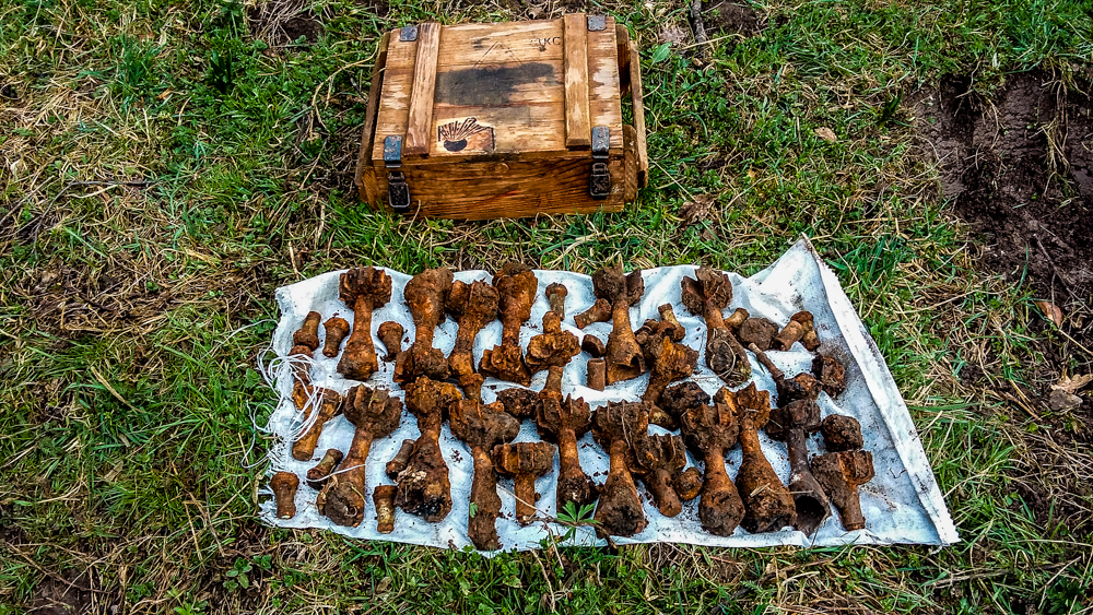
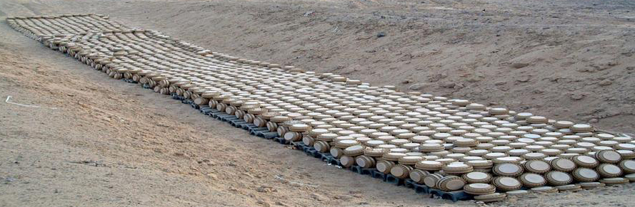
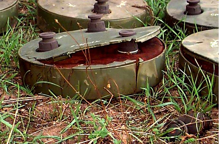
MINE CLEARANCE
This is box titleMine clearance – the removal or destruction of mines in a minefield or mined area. Mine clearance consists in: Defusing – the action of making a mine safe by removing the fuse or igniter. Neutralising – the action of making a mine safe by rendering or ignater inoperable. Destruction – the action of destroing the mine components. -
REQUESTS
This is box titleReconaissance of the road and adiacent sides to be demined; Providing the critical data used for planning and conducting the initial mining (if still available ) and maps containing the demining area at 1:500, 1:1000, 1:2000, 1:5000, 1:25000 scale. Providing national legislation about foreign companies acting on territory mainly about demining activities, transportation and manipulation of hazardous (explosive) materials. Data and information evaluation. Planning and organizing financial and logistic activities and conducting scheduled demining operations according with legislation and signed contracts. -
REQUESTS
This is box titleMaking population aware of the works and conduct Public Relations activities. Creating liaison and cooperation with Armed Forces, Police and local authorities. Creating logistics for: – providing loading, catering and transportation for all employes; – equipment and explosives materials safe storage; – medical support and Medevac in emergency situations; – demining activities support. Conduct demining activities in safe conditions for the company employes, local civilian population and properties. Observing UN procedures regarding humanitarian demining. Handing over of justifing documents and cleared areas -
REQUESTS
This is box titleGeneral survey is the investigation of information already existing and new information gathered about suspect areas in order to identify risk areas and areas without obvious risk. General survey starting with: make a study of maps, plans and informations ghatered from local authorities (Civilian Protection, units of Armies, Police); obtaining of adiotionaly informations concerning mined area from local population (former soldiers, mine victims); preparing of action plan -
REQUESTS
This is box titleTechnical survey needs to be conducted by personnel qualified and equipped for demining, marking and sketching the task done. Tasks : Determine the limits of mined area; Establish the characteristics of mined area (length, wide, tipe of mines); Achievement and marks of base line; Marks of mined area. -
REQUESTS
COMPLETION SURVEYBased on information gathered, borders of suspect areas and areas without obvious risk will be established on either cadastral plan or a map (topographic map exceptionally). Completion Survey is the process where within technical survey the accurate AWOR is identified according to the border of the stated mined area, as well as in clearance for area that is cleared, all in cooperation with the team who conducted the technical survey or clearance. Technically surveyed (stated AWOR) or cleared area, will be walked over, grid references will be set for datum point and all the turning points. All the grids will be documented on the sketch. -
REQUESTS
DISTRIBUTION OF INFORMATIONSAll three survey levels results are transferred into chief of demining structure in reporting forms. All measuring is to be done in metric system, while the equipment chosen must provide the required level of accuracy and reliability to the surveyor. Cadastral and topographic maps are the key elements in gathering geographical information on suspect areas. The most accurate and most detailed maps are to be used as a standard for setting risk areas and areas without obvious risks.